
Pyramid Geophysical Services has performed a multitude of Underground Storage Tank (UST) investigations throughout North Carolina using geophysical methods. These metallic USTs are often left behind at old fuel service stations that have closed down. Old home heating oil tanks are also often left in the ground after … [Read more...]
Seismic (MASW) Surveys to Investigate Top of Rock

One of the most common applications of near-surface seismic testing is to identify the depth of the top of a bedrock unit in the subsurface. The two most effective seismic methods associated with this application are: 1) Seismic refraction, and 2) Multi-Channel Analysis of Surface Waves (MASW). Most people who are … [Read more...]
Geophysical Ground Conductivity Mapping

The use of electromagnetic (EM) geophysical methods to evaluate ground conductivity variations is an effective tool to resolve environmental issues. However, the EM profiling instruments commonly used (such as the Geonics EM31 ground conductivity meter) for such applications provide depth-averaged conductivity values … [Read more...]
Carlsbad Caverns – Resistivity Mapping for Caves

Pyramid Geophysical Services performed a geophysical investigation for the National Park Service at Carlsbad Caverns National Park in Carlsbad, NM. The survey used electrical resistivity mapping (ER) to look for potential underground caves or caverns near an area designated for the construction of an underground … [Read more...]
Electrical Resistivity
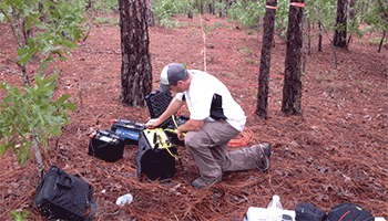
Pyramid utilizes Electrical Resistivity Tomography (ERT) as a surface geophysical tool to provide information to our clients regarding geologic site conditions, hydrogeologic characteristics, and conductivity variability associated with environmental concerns. We utilize the Advanced Geosciences, Inc. (AGI) Supersting … [Read more...]
- 1
- 2
- 3
- 4
- Next Page »
